From Qeshm to Tabas: exploring Iran’s remarkable geodiversity
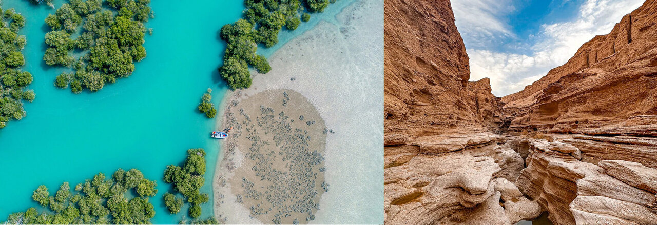
TEHRAN - Iran can be described as a land of remarkable geological diversity, where high mountain ranges, deserts and plains, caves, rock formations, salt domes, valleys, springs, coastlines and erosion-shaped landscapes coexist across its vast territory. This diversity is the result of Iran’s complex geological history and the processes that have shaped the country over millions of years, from the movement and collision of tectonic plates to folding, faulting, volcanic activity, sedimentation and erosion.
International Geodiversity Day, observed on October 6, provides an opportunity to draw attention to this lesser-known dimension of the Earth’s natural heritage. It is also a reminder that protecting nature goes beyond conserving plant and animal species. Rocks, soils, water, minerals, fossils, caves, mountains and landscapes are all part of the planet’s natural capital and geological memory.
Protecting geodiversity, therefore, means safeguarding the history of the Earth, the resources upon which human societies depend, and the foundations of life in the future.
The importance of geodiversity extends far beyond the aesthetic value of natural landscapes. Every geological feature can tell part of the Earth’s history and provide researchers with valuable information about climate change, ancient environments, the formation of mountains and sedimentary basins, and even major events in the history of life. Geological structures are also closely linked to groundwater resources, soils, mineral deposits and the formation of habitats. For this reason, conserving geodiversity is an integral part of protecting a country’s natural capital.
One of the most distinctive examples of Iran’s geological diversity can be found in the south of the country, on Qeshm Island, where tectonic and erosional processes have created a remarkable collection of geological formations and landforms. The UNESCO Global Geopark of Qeshm lies in the southern Zagros Mountains, an area whose geological characteristics have been shaped by the collision of the Arabian and Eurasian plates. The Namakdan salt dome and salt complex, Namakdan Cave, Stars Valley and Chahkooh Canyon are among the area’s most prominent geological features. UNESCO describes Namakdan Cave, with its multicolored galleries and salt crystals, as one of the outstanding elements of Qeshm’s geological heritage.
In northwestern Iran, the Aras UNESCO Global Geopark offers a different picture of the country’s geological diversity. The region contains a wide range of rocks dating from different geological periods, including Paleozoic and Mesozoic carbonate rocks, igneous rocks and sedimentary deposits. One of the geopark’s most important geosites is the Alibashi area, which contains rock and fossil sequences associated with the Permian-Triassic boundary and is internationally significant for the study of one of the major events in Earth’s history. The Aras Geopark was added to UNESCO’s Global Geoparks Network in 2023, with around 30 geosites identified across the area.
Central Iran is home to the Tabas UNESCO Global Geopark, another major expression of the country’s geodiversity, known for the extent and variety of its geological features. The inclusion of Tabas alongside Qeshm and Aras on UNESCO’s list of Global Geoparks demonstrates that Iran’s geological diversity is not confined to a particular region or type of landscape. Valuable examples of the country’s geological heritage can be found across a wide range of environments and regions.
Geoparks, meanwhile, are not simply areas established to display geological features or serve as tourism destinations. The Global Geopark concept seeks to link the conservation of geological heritage with education, research, sustainable tourism and the participation of local communities. In Qeshm, for example, UNESCO has emphasized the connection between natural heritage conservation and sustainable livelihoods, including activities related to geological heritage and tourism. In Aras, geological heritage forms part of a broader natural and cultural heritage landscape encompassing a range of natural and historical attractions.
The mountains, caves, valleys, deserts and geological formations found across Iran contain part of the country’s natural memory and stand as records of the Earth’s evolution. Once destroyed, many of the processes and geological evidence accumulated over millions of years cannot be recreated.
Identifying and documenting geosites, protecting them, raising public awareness and promoting responsible tourism can therefore help turn this lesser-known natural asset into a more prominent component of the country’s broader efforts to conserve its natural heritage.
Leave a Comment